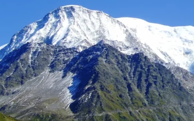
The Col des Fours is a spectacular variant of the famous Tour du Mont Blanc, offering breathtaking views and an unforgettable hiking experience. Located at an impressive altitude of 2665 meters, the Col des Fours is a sought-after destination for hikers seeking stunning mountainous landscapes and a true immersion in nature. This variant of the Tour du Mont Blanc provides a more demanding, yet more rewarding hiking experience, with panoramic views of the surrounding mountains that are simply unmatched. However, it is essential to check the weather and trail conditions before embarking on this route, as conditions can change rapidly in the mountains. Accounts from hikers who have taken this route speak of the region’s wild and preserved beauty, the physical challenges of the climb, and the satisfaction of overcoming these challenges to reach the summit. Whether you are an experienced hiker looking for a new challenge or a nature enthusiast eager to explore mountainous landscapes, the Col des Fours is a destination not to be missed.
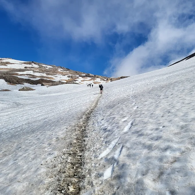
Path leading to the Col des Fours full of snow patches even in summer
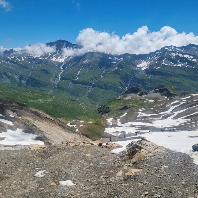
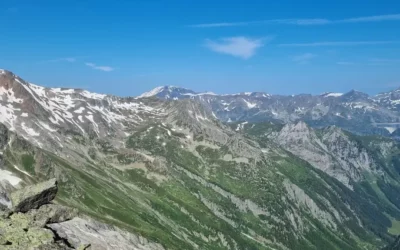
View from the Col des Fours
Example of a route from Refuge de la Balme to Les Mottets via the Col des Fours variant.
T
Download the GPX track of the stage: https://www.visugpx.com/URWmZQHWLG
Elevation gain, altitude, and mileage of the stage

Kilometers
13

Elevation +
1080

Elevation –
877

Max. Altitude
2662

Min. Altitude
1673
Stage Summary
The initial itinerary of this stage coincides with the traditional route, starting at the Refuge de la Balme and climbing over a distance of 4 kilometers with a positive elevation gain of 650 meters to reach the Col du Bonhomme.
As you progress towards the Col de la Croix du Bonhomme, you will face a choice: to take the variant leading to the Col des Fours. This detour propels you to an altitude of 2665 meters, unveiling breathtaking panoramas of the surrounding mountains. Before embarking on this variant, it is crucial to consult the weather forecasts and assess the trail conditions. Depending on the time of year, you may encounter numerous snow patches, making some sections potentially dangerous, even in summer.
Once at the Col des Fours, a 5-kilometer descent with a negative elevation gain of 900 meters will lead you to the Ville des Glaciers. Enjoy a break at the alpine pasture to savor some local cheese, a regional specialty, before continuing your journey to the Refuge des Mottets.
The Refuge des Mottets marks your last stop before crossing the Italian border the following day. It is advised to book your spot if you plan to spend the night at the refuge. Note that it is forbidden to bivouac on the refuge’s grounds, which are quite extensive. However, you have the option to set up your tents before arriving at the refuge, near the ruins (about 5/10 minutes before the refuge), or after by starting the climb towards the Col de la Seigne, just behind the first “peak” visible from the refuge.
Points of interest of the stage
Col du bonhomme
Col des fours
Where to sleep?
Refuge des Mottets
Bivouac before the Refuge des Mottets near the ruins. Set up your tents quickly as it fills up very fast.
Bivouac after the Refuge des Mottets (directly after the first climb towards the Col de la Seigne)